- Name
- Colibri-S
- Alternate Names
- Колибри-С, RS67S
- Satellite ID
- OVBN-0332-6282-0409-5232
- NORAD ID
- 61746
- Website
- https://spacepi.space/satellites/colibri-s/
- Country of Origin
-
Russia
Satellite is in orbit and operational
- Launch Date
- 2024-11-04T00:00:00+00:00
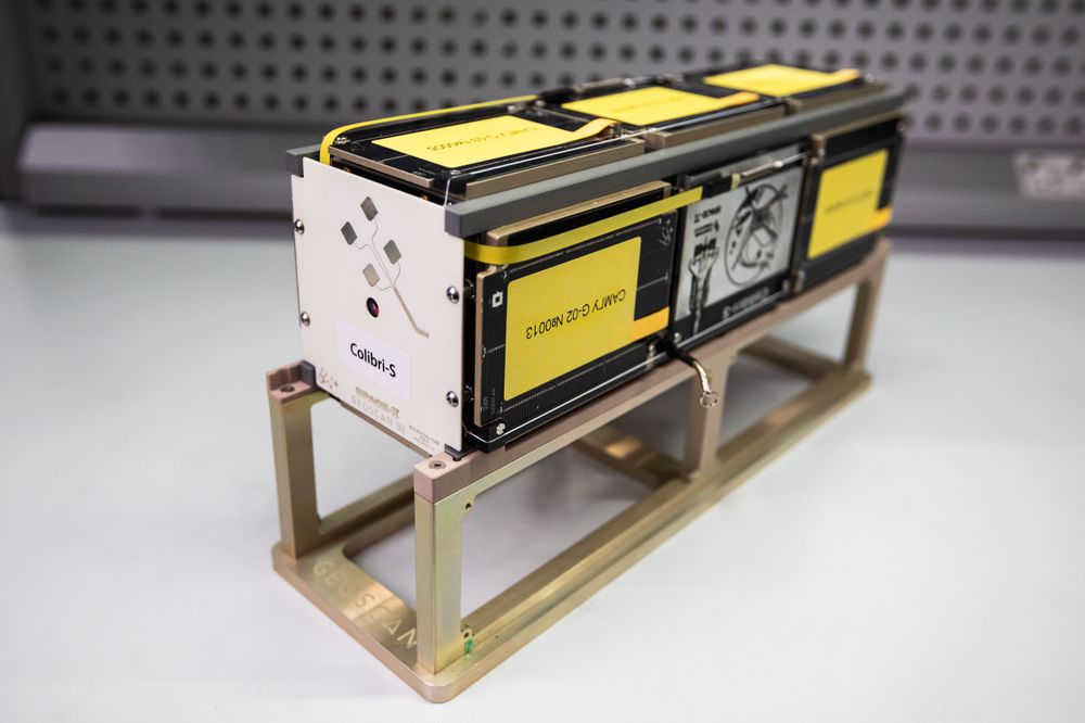
The Colibri S spacecraft is a small satellite designed to perform educational tasks in the field of radio communications and Earth remote sensing, acquisition of hyperspectral images of the Earth surface, as well as educational activities within the framework of the Space pi project of the Dezhurnyj po planete programme of the FASIE. The payload installed on the spacecraft is a 10x15 mm near-infrared hyperspectral camera of the scanning slit type with a diffraction optical element based on a grating on a convex mirror with a Rubinar 4.5 300 mm lens for obtaining hyperspectral images of the Earth surface. The Colibri S spacecraft is intended for educational, self study and technical research purposes conducted by radio amateurs. Radio amateurs will be able to track the spacecraft and receive telemetry and payload information. Anyone interested will be able to participate in the planned transmissions. It is also possible to transmit text, telemetry and remote sensing data, including using the amateur radio X-band, at any time and at any point during the pass, as agreed. In case of successful reception, the mission team will be able to assist in decoding and interpreting the received signal, as well as in processing the received images.
- Type
- Transmitter
- Service
- Amateur
- Downlink Mode
- DVB-S2
- Downlink Frequency
- 10475000000
- Baud
- 1000000
- IARU Coordination
- IARU Coordinated
- Type
- Transmitter
- Service
- Amateur
- Downlink Mode
- CW
- Downlink Frequency
- 436835000
- IARU Coordination
- IARU Coordinated
- Type
- Transmitter
- Service
- Amateur
- Downlink Mode
- GFSK
- Downlink Frequency
- 436835000
- Baud
- 9600
- IARU Coordination
- IARU Coordinated
| Observer | Latest Data |
|---|---|
| PV8DX-FJ92pt | 2026-05-26 12:36:18 UTC |
| OE6ISP_2-JN77pa | 2026-05-26 10:11:15 UTC |
| OE6ISP_1-JN77pa | 2026-05-26 10:11:15 UTC |
| OE6ISP_8-JN77pa | 2026-05-26 10:09:23 UTC |
| PE0SAT-JO21mr | 2026-05-26 08:11:00 UTC |
- Script Name
- geoscan
- Decoder Fields
- Click here
- TLE Source
- Space-Track.org
- TLE Updated
- 2026-05-26 11:26:29 UTC
- TLE Set
-
1 61746U 24199M   26146.26677863  .00023424  00000-0  46953-3 0  9998
2 61746  97.3032  19.9342 0008441  14.3995 345.7493 15.46682804134025