Suggested Edit for Satellite
Suggested by geoscan on: 2024-03-03 21:48
Citation: https://www.n2yo.com/satellite/?s=29710#results
Verdict: Approved
Reviewed by - on: 2024-03-03 23:05
| Name | CARTOSAT-2 |
| NORAD ID | 29710 |
| Followed NORAD ID | - |
| Alternative Names | IRS-P7 |
| Description | CartoSat 2A is an Indian photo-imaging craft that was launched by a PSLV-C7 rocket from Sriharikota at 03:57 UT on 10 January 2007. The 680 kg craft will provide panchromatic images at one-meter resolution, to aid civil planning, and other cartographic needs. |
| Owner/Operator | - |
| Status |
|
| Countries of Origin | |
| Website | - |
| Dashboard URL | - |
| Launch Date | Jan. 10, 2007, midnight |
| Deploy Date | - |
| Re-entry Date | Feb. 14, 2024, midnight |
| Image | 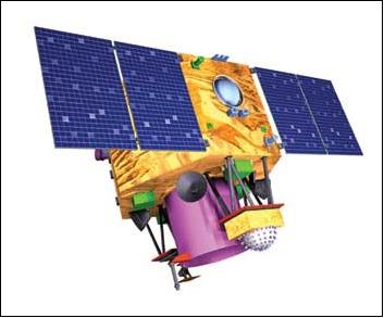 |
| Field | Previous | Suggested |
|---|---|---|
| Status |
|
|
| Re-entry Date | - | Feb. 14, 2024, midnight |