Suggestion for New Satellite
Suggested by - on: 2021-07-21 10:11
Citation: CITATION NEEDED - https://xkcd.com/285/
Verdict: Approved
Reviewed by - on: 2021-07-21 10:11
| Name | CARTOSAT-2A |
| NORAD ID | 32783 |
| Followed NORAD ID | - |
| Alternative Names | - |
| Description | CartoSat 2A is the primary Indian remote sensing craft among the fleet of 10 satellites that were launched by a PSLV 9 rocket from Sriharikota in southeastern coast of India at 03:54 UT on 28 April 2008. The 690 kg, 900 W, triaxially stabilized craft carries a panchromatic camera to provide 0.5-0.85 micron images at one meter resolution in a swath of 9.6 km. It can be steered along track as well as across track to enable repeated images of a chosen site, frequently. The images will be used in rural and urban planning. |
| Owner/Operator | - |
| Status |
|
| Countries of Origin | |
| Website | - |
| Dashboard URL | - |
| Launch Date | - |
| Deploy Date | - |
| Image | 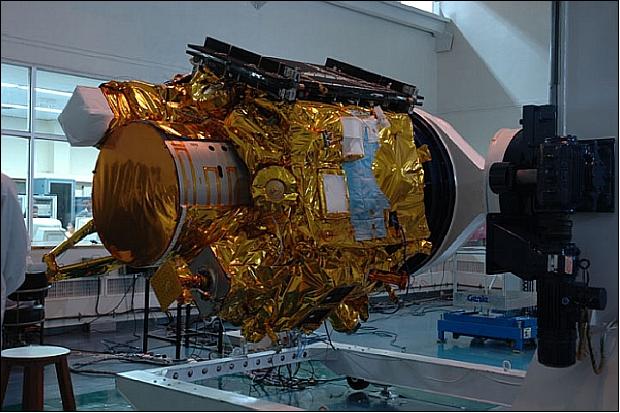 |